RTK vs LiDAR Robotic Mower Navigation
A clear comparison of RTK satellite positioning and LiDAR laser navigation for wire-free robotic mowers on acreage yards.

On this page
Top picks at a glance
As an Amazon Associate I earn from qualifying purchases.
- 1
 Segway Navimow i105N Robot Lawn Mower Perimeter Wire Free 1/89.5/10View on Amazon
- 2
 DREAME Robot Lawn Mower Decal for A3 AWD Series9.5/10View on Amazon
- 3
 ECOVACS Goat O1000 RTK Care Robot Lawn Mower9.3/10View on Amazon
- 4
 ECOVACS Goat O1000 RTK Robot Lawn MowerView on Amazon
- 5
 Lymow One Plus Robot Lawn MowerView on Amazon
- 6
 Sunseeker X3 Plus Robot Lawn MowerView on Amazon
- 7
 Sunseeker X5 AWD Robot Lawn MowerView on Amazon
When comparing RTK vs LiDAR robotic mower navigation, the choice comes down to satellite line of sight versus local laser mapping. RTK (Real-Time Kinematic) uses satellite positioning with a base antenna or network correction to locate the mower. LiDAR (Light Detection and Ranging) uses laser pulses reflecting off surroundings to build a layout map. For open lawns with clear sky views, RTK delivers straight passes across unobstructed turf. Where dense tree canopy, overhanging eaves, or tall privacy fences block satellite signals, LiDAR provides reliable positioning by mapping physical boundaries directly. This guide compares both systems step by step to help you choose the right setup.
Other machines to compare
 ECOVACS Goat O1000 RTK Robot Lawn MowerCheck price on Amazon
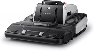 Lymow One Plus Robot Lawn MowerCheck price on Amazon
 Sunseeker X3 Plus Robot Lawn MowerCheck price on Amazon
 Sunseeker X5 AWD Robot Lawn MowerCheck price on Amazon
AcreMowerLab earns a commission when you shop through links here. It never changes your price. Affiliate disclosure.
RTK vs LiDAR robotic mower navigation: pick the right system
| Navigation system | How it positions | Best yard layout | Main limitation |
|---|---|---|---|
| RTK (Real-Time Kinematic) | Satellite signals corrected by a local antenna or network | Open terrain with clear sky views and few tall obstacles | Standalone satellite signal drop under dense canopy and beside tall structures |
| LiDAR (Light Detection and Ranging) | Laser light pulses measuring distance to physical surroundings | Yards with dense tree cover, shade, fences and narrow paths | Requires physical landmarks and clean optical sensor surfaces |
| Hybrid (RTK or LiDAR with Vision) | Satellite or laser positioning paired with optical AI cameras | Mixed layouts with open fields, tree lines, and structures | Higher equipment complexity with multiple onboard sensor systems |
Most wire-free robotic mowers rely on one of these navigation methods to cut in clean, parallel passes without buried boundary wires. For properties with wide turf expanses, satellite positioning keeps cuts aligned across distance. See our guide to the best robotic mower for large lawns to compare wire-free models by acreage capacity.
Step 2: assess tree canopy and sky exposure
Satellite positioning relies on clear line of sight to orbiting satellites. Overhead foliage can absorb or deflect signals, creating multipath interference that weakens standalone satellite reception under dense branches. In contrast, LiDAR uses active laser emission directly from the mower chassis, bouncing pulses off trunks, walls, and terrain so overhead branches do not disrupt positioning.
ECOVACS lists the Goat O1000 LiDAR PRO with dual-LiDAR positioning for lawns up to 1/4 acre, noting it maintains 2 cm positioning accuracy under trees and in shaded areas where satellite systems lose signal. Similarly, dreame lists the A3 AWD Pro 3500 with 360 3D LiDAR for lawns up to 0.87 Acre, maintaining navigation near trees and fences without boundary wires.
Step 3: inspect tall walls, buildings and fences
Yard structures affect signals differently. Multi-story homes, metal outbuildings, retaining walls, and tall perimeter fences can block horizon satellites from a standalone RTK antenna, reducing positioning accuracy near borders.
LiDAR uses physical structures as navigation landmarks. As the mower follows a fence or foundation, laser sensors measure precise distances to solid barriers. MOVA lists the LiDAX Ultra 1000 for lawns up to 1/4 acre (0.25 acre in specs) with 360° 3D LiDAR, maintaining centimeter accuracy near walls and cutting within 2 inches of raised borders. SUNSEEKER lists the S4 for 0.25 Acre yards (10,890 sq. ft.) with 360° 3D LiDAR, handling narrow passages down to 31.5-inch width along fences and eaves.
Step 4: evaluate base station and antenna setup
Traditional RTK mowers require an external base station antenna mounted in an elevated spot with an unobstructed sky view to broadcast correction data to the mower. Finding a location with clear sky visibility and power access requires planning.
Network RTK (NetRTK) and LiDAR avoid dedicated antenna masts. Network RTK receives correction data over an internet connection: LOPKIN lists the L2500-NEO combining NetRTK, AI vision, and GNSS/INS fusion for lawns up to 0.9 acres without a local antenna, including a Wi-Fi HaLow router providing coverage reaching up to 20 acres in open areas. LiDAR mowers house all mapping sensors onboard: HOOKII lists the Neomow X SE with 360° 3D LiDAR for lawns up to 0.75 Acre without an RTK antenna, operating with positioning error under 0.8 inches (2 cm).
Step 5: match navigation to your lawn acreage
Property dimensions and layout influence navigation choice. Satellite signals cover open turf effectively as long as the antenna maintains sky line of sight: LOPKIN lists the L2500-NEO with NetRTK for coverage up to 0.9 acres, while ECOVACS lists the Goat O1000 RTK for lawns up to 1/4 acre.
LiDAR systems map boundaries and landscape features directly from the chassis across varied capacities: SUNSEEKER lists the S4 for 0.25 Acre yards (10,890 sq. ft.), roborock lists the RockMow X120H LiDAR for lawns up to 0.49 Acre, HOOKII lists the Neomow X SE for lawns up to 0.75 Acre, ECOVACS lists the Goat A3000 LiDAR PRO for lawns up to 3/4 acre, and dreame lists the A3 AWD Pro 3500 for lawns up to 0.87 Acre. Readers evaluating whether robotic mowers work on large lawns should weigh yard acreage alongside tree cover.
Set up signal and sensor zones
Large properties often divide into distinct areas with varied signal conditions. An open front lawn may receive clear satellite reception, while a wooded back lawn has heavy canopy cover. Multi-zone mapping in mobile apps lets homeowners set custom schedules, transit pathways across driveways, and exclusion zones around garden beds.
MOVA lists the LiDAX Ultra 1000 with support for 2 independent maps and up to 150 managed zones. SUNSEEKER lists the S4 with capacity for 5 maps and up to 100 zones or no-go areas. ECOVACS lists the Goat O1000 RTK navigating narrow passages down to 2.3 ft between lawn zones.
Match navigation to your yard layout
Match navigation hardware to your landscape layout:
- Open turf with clear sky: RTK satellite navigation delivers straight passes across unshaded ground without relying on nearby structures.
- Wooded lots and heavy canopy: LiDAR maintains steady positioning beneath dense branches without satellite dropouts.
- Complex layouts with narrow corridors: LiDAR measures distances to walls directly, while hybrid models like the ECOVACS Goat O1000 RTK navigate passages down to 2.3 ft using vision assist.
- Hilly terrain: Both navigation types track on slopes, while drive design governs traction.
Slope ratings depend on chassis build: roborock lists the RockMow X120H LiDAR with all-wheel drive handling slopes up to 80% (38.7°), dreame lists the A3 AWD Pro 3500 climbing slopes up to 38.7° (80%) with 4WD, and ECOVACS lists the Goat A3000 LiDAR climbing slopes up to 50% (27°).
Plan boundary mapping and multi-zone management
Virtual boundaries eliminate digging trenches for perimeter wires. With satellite mowers, mapping involves guiding the unit along lawn borders via an app to log coordinates.
LiDAR mowers map boundaries by scanning surroundings with laser pulses as they travel. Homeowners can set off-limit zones around flower beds and pools. HOOKII lists the Neomow X SE supporting up to 40 customized areas with no-go zones, avoiding objects down to 0.4 inches (1 cm) wide and 5.9 inches (15 cm) high. ECOVACS lists the Goat A3000 LiDAR recognizing over 200 common garden obstacles with AI vision and 3D ToF LiDAR.
Mind the weather and sensor care
Wet grass can cause wheel slip and deck clumping, so most autonomous mowers include rain sensors that pause mowing during storms to protect turf.
Lighting impacts sensors differently. RTK satellite reception is unaffected by daylight or darkness. LiDAR emits its own light, mapping in bright sun, dim light, or total darkness. Keep optical lenses clean by wiping away dust and grass residue. At season end, clean the chassis and store the unit indoors; see our guide on storing a robotic mower in winter. HOOKII lists the Neomow X SE with an IPX5 waterproof rating for rinsing the chassis, while ECOVACS lists the Goat A3000 LiDAR with an IPX6 waterproof rating.
Safety
Robotic mowers feature lift sensors and tilt sensors that shut down cutting blades immediately if the mower is raised or tipped. Obstacle sensors scan for stationary and moving objects, steering clear of lawn furniture, tools, and toys.
Clear sticks, stones, and wire before mowing. Keep children, pets, and bystanders off the lawn during operation. Configure a PIN code to prevent unauthorized use, and do not exceed the maker’s maximum slope rating. Review our walk-behind and robotic mowers section for equipment details. dreame lists the A3 AWD Pro 3500 detecting over 300 obstacles with binocular AI vision and 360 3D LiDAR. roborock lists the RockMow X120H LiDAR with PIN and anti-theft tracking.
FAQ: mowing large lots
Should you choose RTK or LiDAR for your lawn?
Choose RTK if your lawn consists of open grass with clear sky views. Choose LiDAR if your yard features dense tree canopy, tall fences, or shaded corridors where satellite signals suffer interference.
Does LiDAR robotic mower navigation work under dense trees?
Yes. LiDAR projects independent laser pulses off physical surfaces, so overhead branches and leaves do not block navigation.
Does RTK navigation require a monthly subscription fee?
Standard RTK mowers with a dedicated base antenna do not require subscriptions. For Network RTK, LOPKIN lists the L2500-NEO offering NetRTK with no subscription required.
Can LiDAR and RTK robotic mowers operate at night?
Yes. RTK satellite signals pass freely through night skies, and LiDAR generates its own laser light without needing daylight.
Do RTK and LiDAR mowers require perimeter boundary wires?
No. Both systems are wire-free, using smartphone apps to set virtual boundaries and no-go zones.
More mowing guides
- Best Robotic Mower for Large Lawns: 4 Wire-Free Picks
- Do Robotic Mowers Work on Large Lawns?
- Best Robotic Mower Under 3000 (2026): 5 Wire-Free Picks
- How to Store a Robotic Mower in Winter
Consult our walk-behind and robotic mowers section to compare wire-free models, yard sizes, and cutting features.